Overview
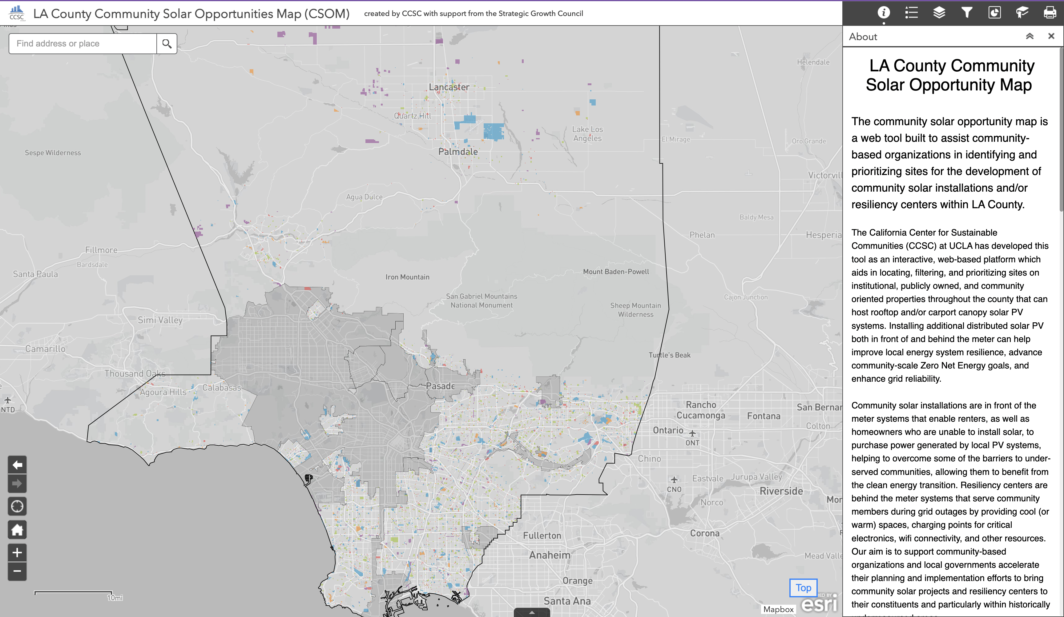
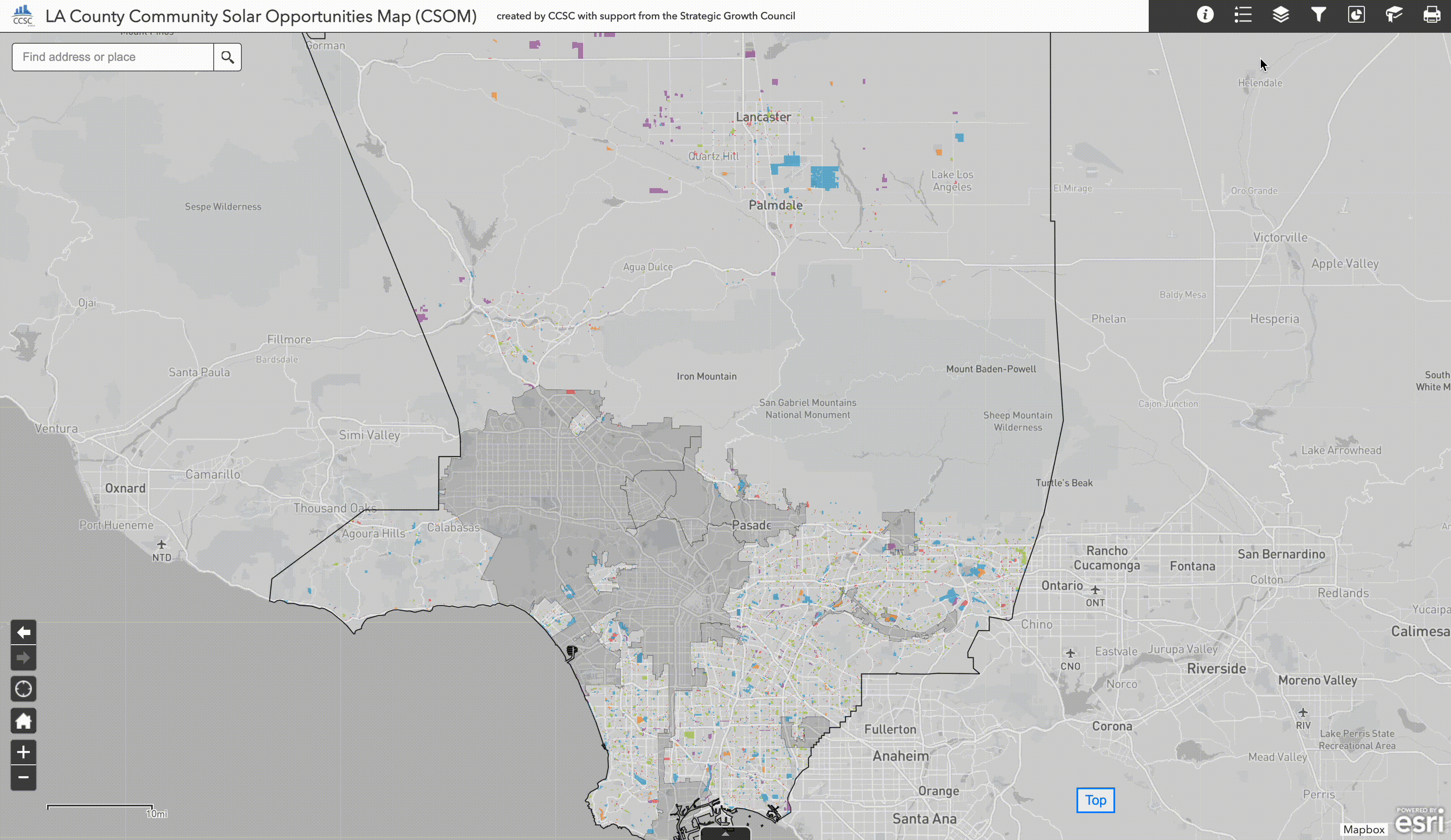
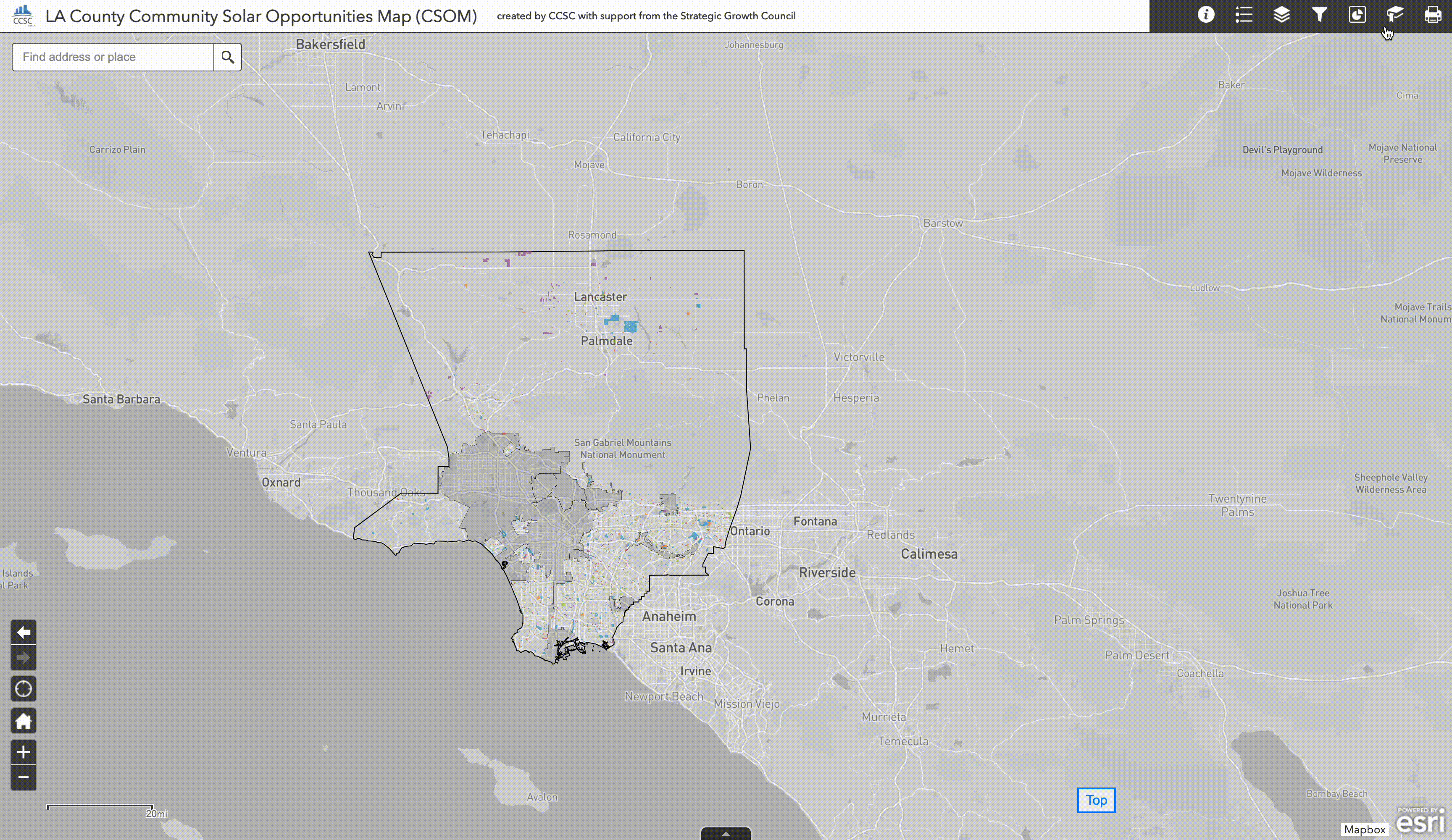
When community solar opportunities map loads, two elements appear on the screen: a map panel and a widget panel (right side). A custom basemap has been developed using Mapbox which highlights the administrative boundary of Los Angeles County, grays out the service territory of LADWP** and restricts reference annotation text elements to only those geographic points of interest most relevant to this project.
 Click on image to view larger size
 ** Service territories for LADWP and other municipally owned utilities are grayed out because key data inputs about grid distribution circuit capacities were unavailable in these areas.
After the solar opportunity map loads, the map is divided into three panels, one of which is minimized by default.
- Map Panel
- Widget Panel
- Attribute Table Panel (Minimized by Default)
Map Panel
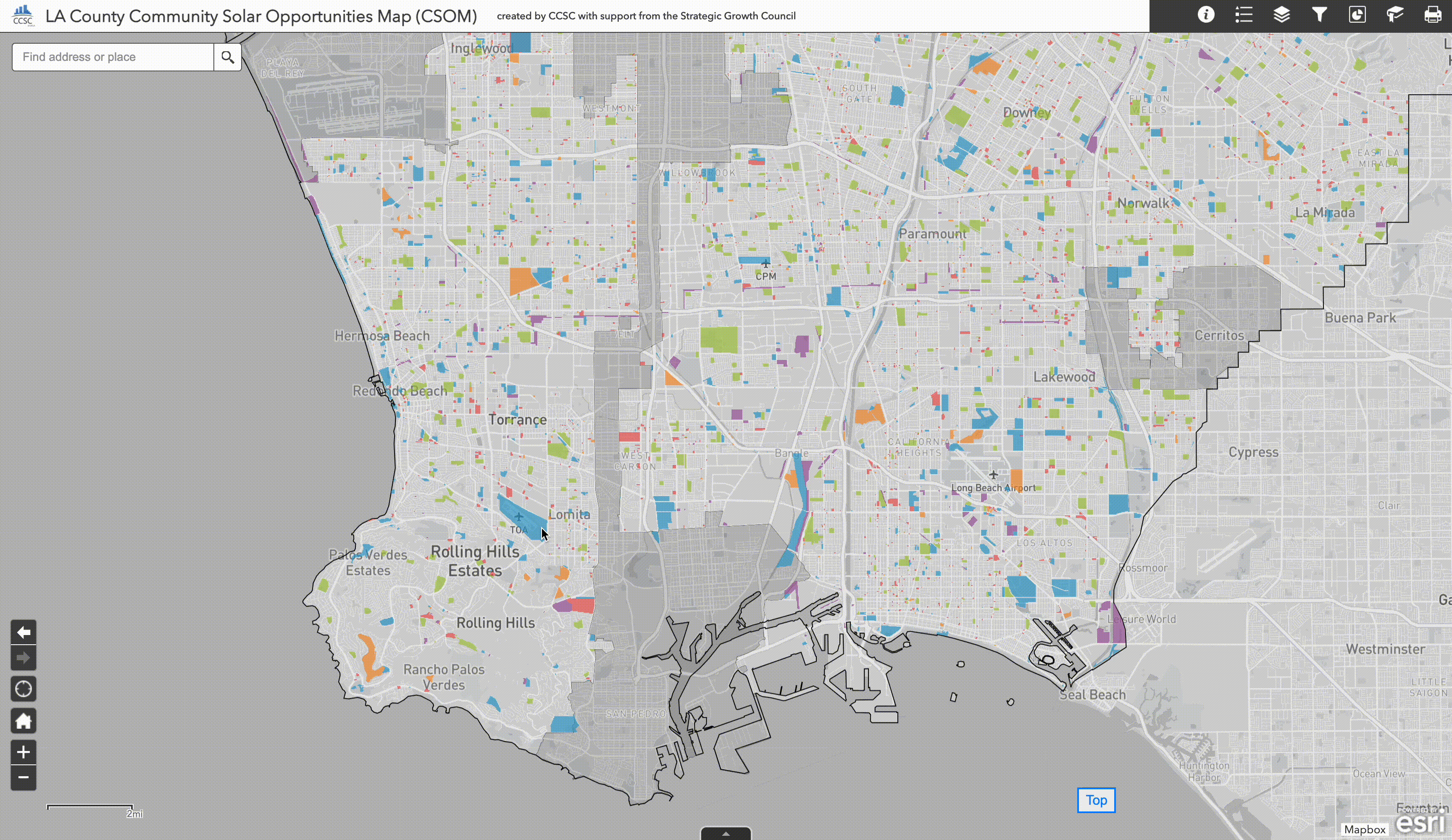
Within the map panel there are a series of interactive elements which can be used to explore different sources of geographic information as well as adjust the zoom level or search for geographic locations of interest. On the upper left portion of the map panel is a search bar which can be used to find addresses, points of interest, and other geographic areas. On the bottom left are a series of navigational tools for zooming and panning through the map. The home icon provides a convenient way to return to the default geographic extent and zoom level if ever you find yourself lost.
Widget Panel
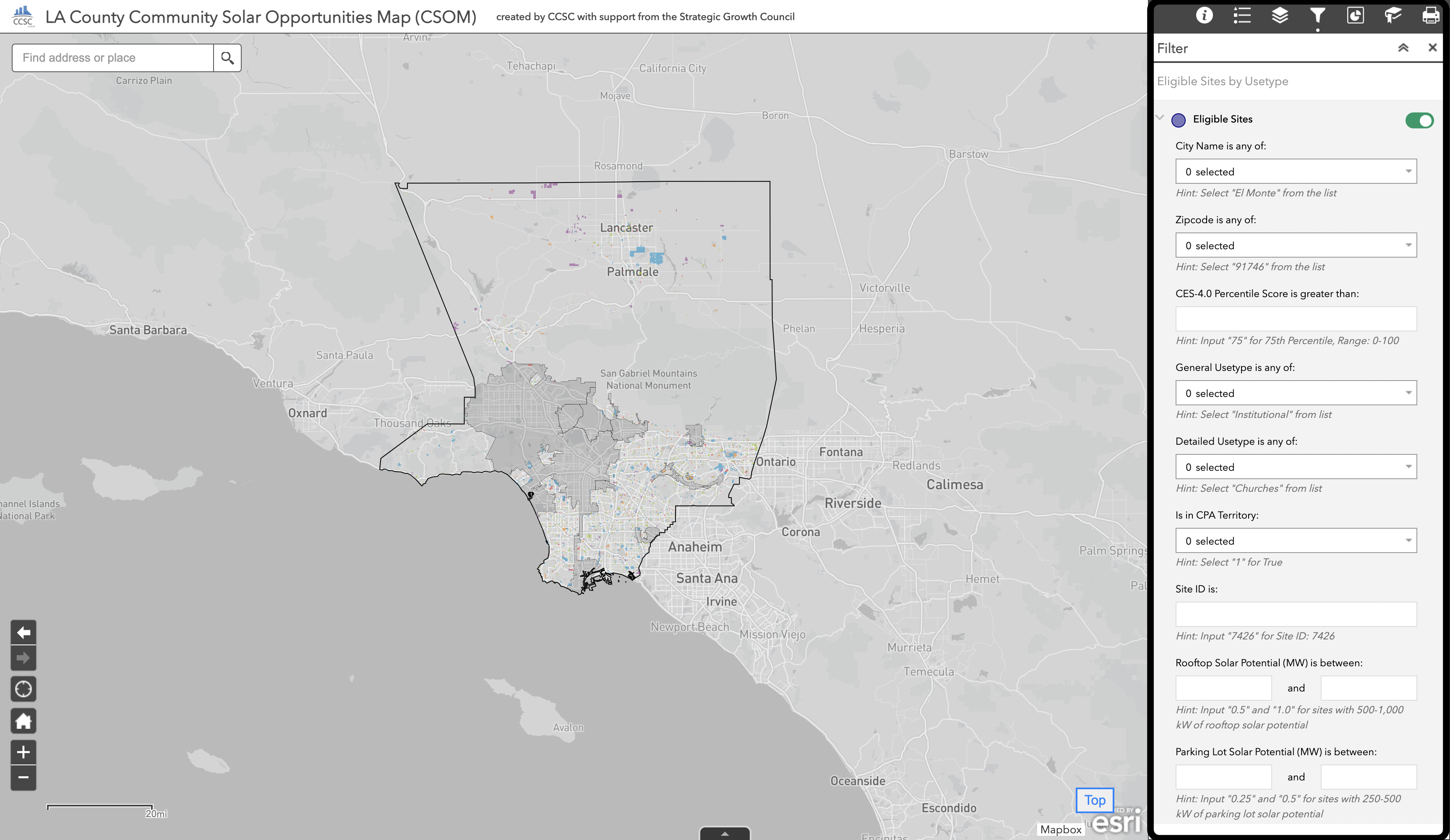
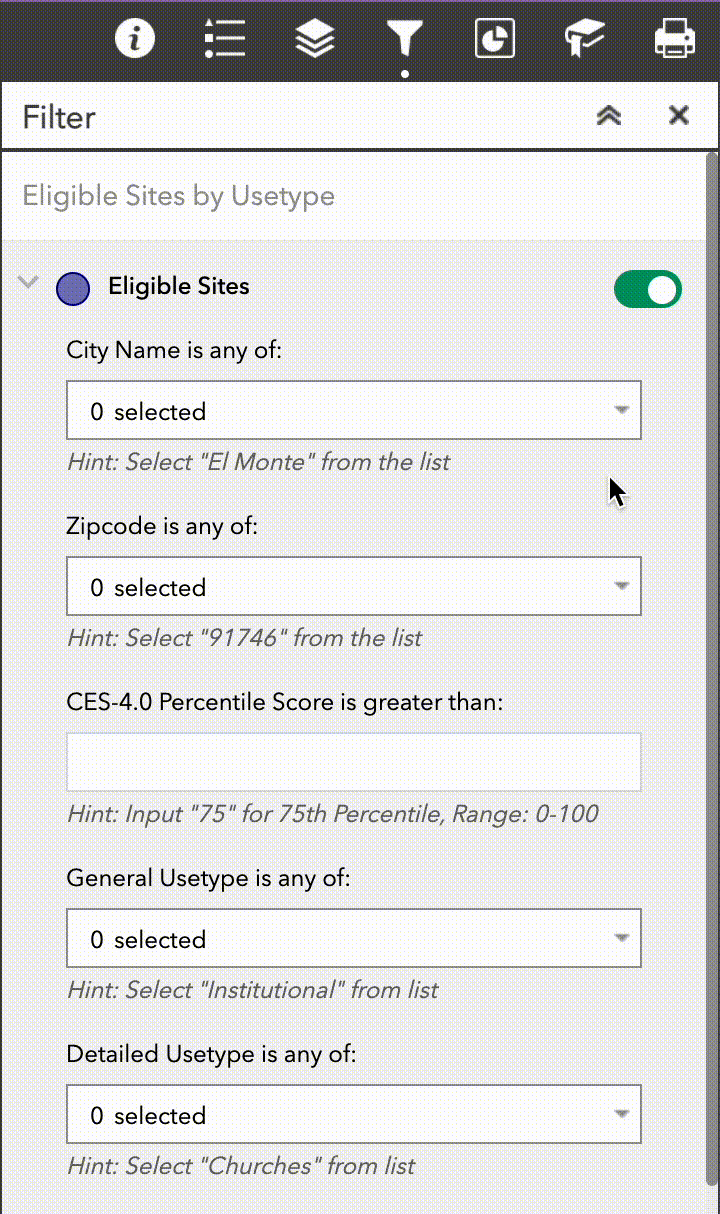
Within the Widget Panel, the following elements are available: Information, Layer List, Legend, Filter, Infographics, Bookmarks, and Print. These elements provide the functionality to perform such tasks as: interactively selecting the layers that are visble in the map, iteratively apply filters to the layer of eligible sites, explore infographics and charts, create and navigate bookmarked areas, as well as generate print outs of the map's data. The ArcGIS web map service refers to these tools as "widgets" and the following sections describe each element in turn.
Among the most important of these widgets are the filters. These filters allow the selection of sites by numeric, categorical, and boolean attributes. The features and suggested patterns of use of these filtering tools are discussed in later sections. Think of the filters as building blocks. They can be combined to meet the requirements of your site selection. Each "Get Started" example on the Solar Map page gives an example of suggested use for each component filter.
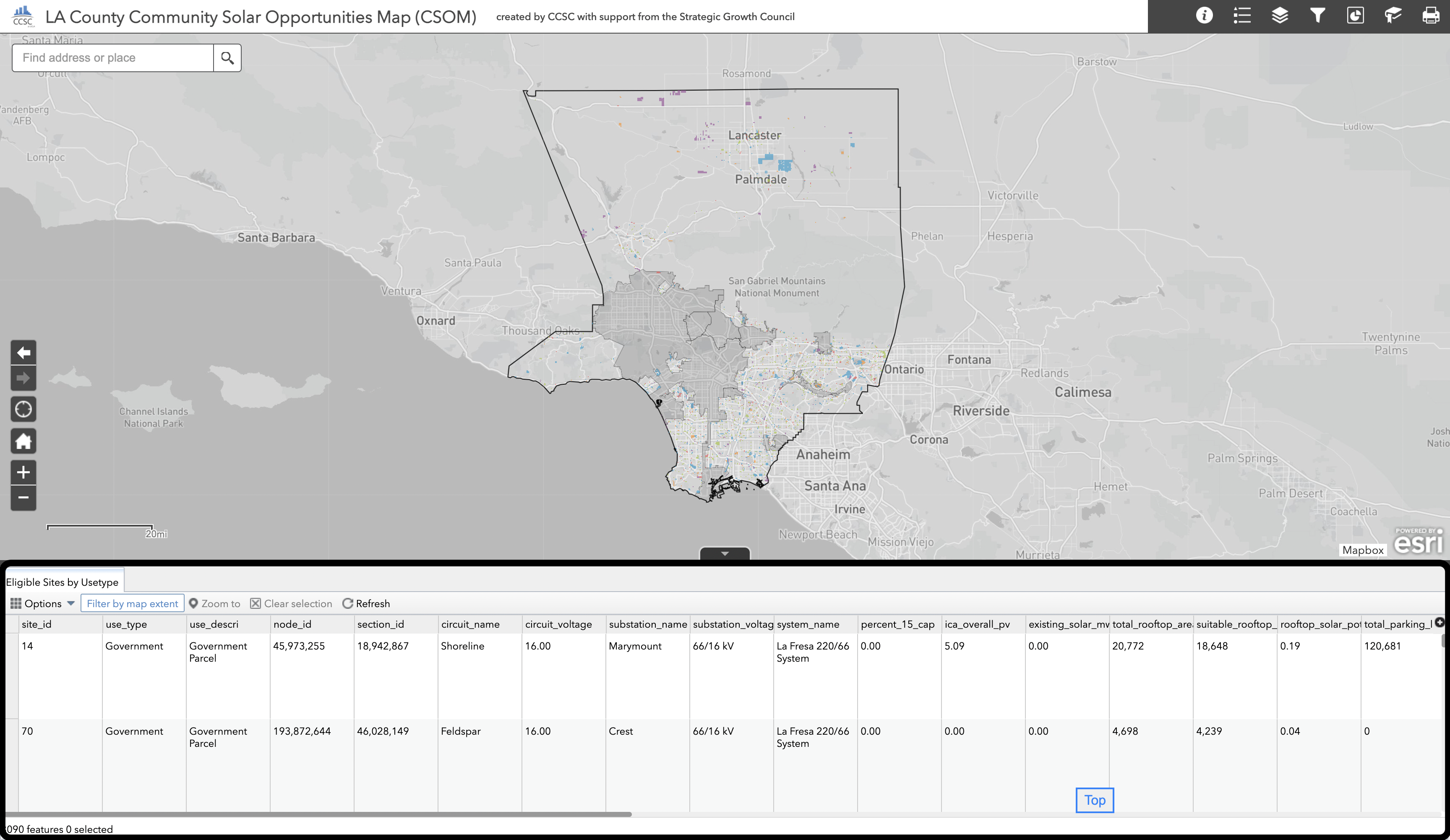
Attribute Table Panel
At the bottom of the screen is a small grey arrow that, when clicked, will make visible the attribute table panel that is minimized by default. This panel provides a tabular view of the underlying data which is being represented in the map. This attribute table panel allows for the detailed selection, sorting, filtering, and inspection of all of the attributes for any layer that is visible within the current map view.
The attribute table panel provides an extremely powerful set of tools which allow the user to view, sort, and filter sites by their different attribute values. The attribute table panel can also be used to directly export tabular CSV data files for sets of eligible sites that have been selected through the application of various filters.
Available Map Layers
Different contextual data layers can be toggled on and off by navigating to the layer selection pane within the widgets panel. Users can easily choose which data layers they want to be visible within the map by clicking their associated check boxes. If a layer appears to be grayed out in the layer pane then this means that it cannot be made visible at the current map zoom level. Try zooming in closer to make the layer accessible for use.
Eligible Sites by Usetype
The primary layer, whose attributes are linked to all of the interactive selection filters, is titled "Eligible Sites by Usetype" within the layer control panel. This layer corresponds to the following categories of publicly-owned and community-oriented properties considered eligible for potential selection for the location of a community scale solar PV generation system that could potentially be used to support a resilience center or as the anchor location for a community solar virtual net metering program. The five general use types of eligible sites which are available for selection include:
- Institutional (e.g. Churches, Hospitals)
- Educational (e.g. Schools)
- Government (e.g. Library, Post Office)
- Recreational (e.g. Clubs, Lodge Halls)
- Miscellaneous (e.g. Utility properties)
There are, additionally, the following 31 separate detailed usetype categories which can also be used to performed detailed site filtering:
- Athletic & Amusement Facilities
- Bowling Alleys
- Camps
- Cemeteries, Mausoleums, Mortuaries
- Churches
- Clubs., Lodge Halls, Fraternal Organizations
- Colleges, Universities (Private)
- Elementary
- Elementary - High Combination
- Elementary - Intermediate/Middle/Junior High Combination
- Golf Courses
- Government Parcel
- High School
- Homes For Aged & Others
- Hospitals
- Institutional
- Middle/Junior High
- Intermediate/Middle/Junior High - High Combination
- Miscellaneous
- Open
- Petroleum & Gas
- Pipelines, Canals
- Race Tracks
- Recreational
- Rights of Way
- Rivers & Lakes
- Schools (Private)
- Skating Rinks
- Theaters
- Utility Commercial & Mutual: Pumping Plants
- Water Recreation
- Water Rights
City Boundaries
A boundary layer containing the borders of Los Angeles County's 88 cities as well as unincorporated areas. This layer is included to provide geographic context for the focused search of eligible sites within a particular city or region of interest.
Zipcode Boundaries
A boundary layer containing the borders of Los Angeles County's zipcodes. This layer is included to provide geographic context for the focused search of eligible sites within a particular zipcode of interest.
County Supervisorial District Boundaries
A boundary layer containing the borders of Los Angeles County five Supervisorial Districts. This layer is included to provide geographic context for the focused search of eligible sites within a particular Supervisorial District of interest.
EV Charging Stations by Access Type
Point locations of Electric Vehicle Charging Stations are provided as a contextual layer. EV Charging Stations displays stations in three categories: public, private and other. Information like charging time availability, network, and pricing is available when a site is clicked on the map.
USEPA Brownfield Sites by Status
Point locations of USEPA designated Brownfield sites within Los Angeles County are provided as an additional contextual layer. Brownfield sites are color coded according to their activity status.
Distribution Circuit by Behind the Meter PV Integration Capacity Limits
This layer shows the location of distribution circuits and displays their behind the meter 15% penetration capacity (MW) limits. Click on a circuit to see additional information about the distribution circuit, including existing, queued, and total generation.
Distribution Circuits by In Front of the Meter Integration Capacity Limits
This layer shows the location of distribution circuits and displays their in front of the meter ICA overall PV integration capacity (MVA) limits. Click on a circuit to see additional information about the distribution circuit, including its associated substation and system.
Census Tracts by CES-4.0 Disadvantaged Community Status
The DAC Census Tracts is an additional boundary layer displaying the 25% highest scoring census tracts in CalEnviroScreen 4.0. These areas are designated as Disadvantaged Communities (DAC) by the California Office of Environmental Health Hazard Assessment. This is provided as a layer for equity considerations in the search for eligible sites.
Census Block Groups by Renter Household Percentage
This layer plots the percentage of the population that are renters within each Block Group in Los Angeles County. This information provides useful context to the energy consumption per household data described for the circuit groups and can be useful for identifying, at the macro scale, cities or regions that should be focus areas for the exploration of eligible sites. Click on a feature in this layer to find more information on Census Block Groups including total population and more detailed housing statistics.
Census Block Groups by Average Annual Electricity Usage (kWh/year) Per Renter Household
This layer contains estimates of the total annual electricity consumption per capita within collections of census block groups (kWh/year). These census block groups reflect the most granular spatial unit at which residential electricity consumption data, sourced from the UCLA Energy Atlas, have been aggregated to generate estimates of annual electricity use per capita and per household throughout the region. A circuit group is a collection of census block groups which are associated with the same distribution circuit. Click on a feature to find the total residential electricity usage (kWh/year) for both renter and owner-occupied households.
Using the Map
How to use a filter
To open a filter, navigate to the icon on the widget panel that looks like a funnel. Clicking this icon will bring up the filter pane which appears a series of statements. Providing an answer to each statement (either by selecting an option through a drop-down menu or inputting a value into an empty text box) activates that component of the filter. You can think of these different filter components as building blocks. They can be combined and explored based on your custom requirements for selecting a site.
Using a numerical filter
Categorical filters allow you to filter eligible sites based on data-defined categories. For example: city name, usetype, CPA territory, etc. To use a category filter: click on the drop-down window and select the category or categories of interest. It is also possible to search for a category and then select from a set of potential matches.
In the example illustrated below, we show how sites which are located in multiple different cities can be added to a new selection through the use of the City name filter dropdown window. This selection can then be cleared by clicking the trashcan icon on the bottom right hand side of the dropdown window.
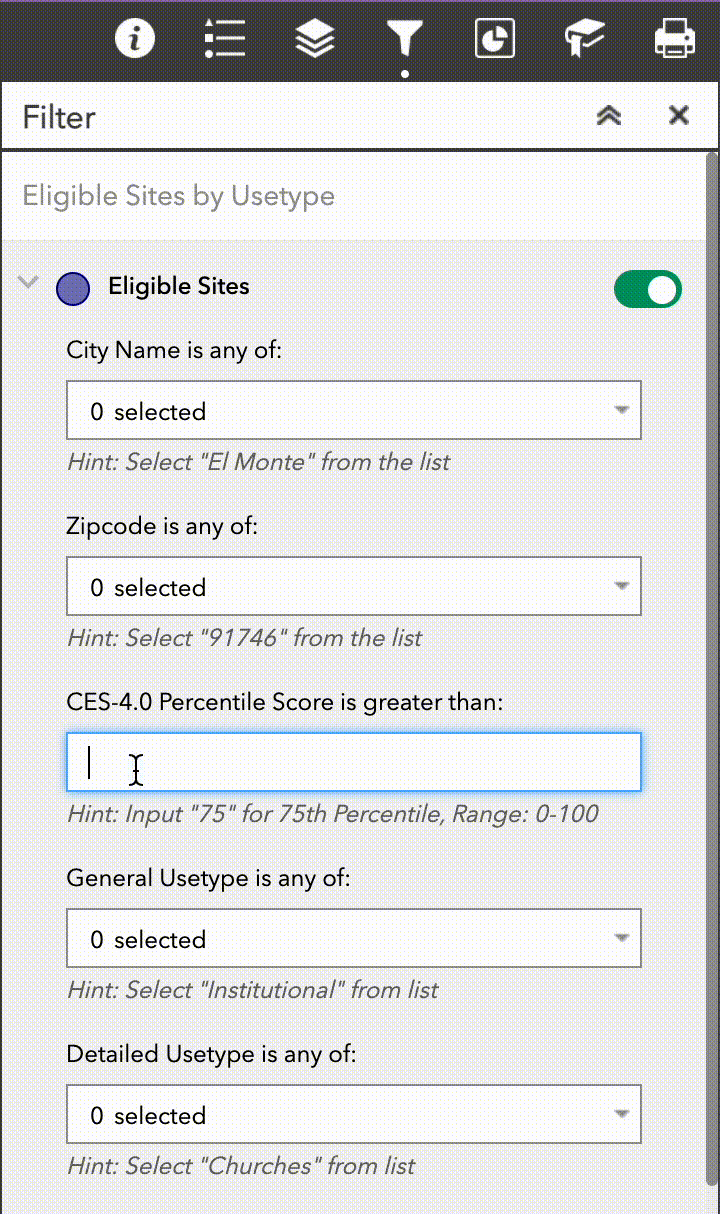
Using a numerical filter
Numerical filters allow you to select eligible sites by setting either a threshold or range of desired values. For example: Grid Circuit Capacity, CalEnviroScreen 4.0 Scores, and Combined Solar Potential are all numerical attributes that can be filtered in this way. These filters are largely self descriptive and provide helpful hints as to what types of input values will produce a meaningful selection result.
In the example illustrated below, we show how you can navigate to the CES-4.0 Percentile Score filter and input a threshold value of 75. This will create a selection of sites that is restricted to only those which fall within census tracks with a CalEnviroScreen-4.0 score of 75% or more.
Description of Filters Available on the Map
City Name is any of: Filter eligible sites by the City they reside in.
Zipcode is any of: Filter eligible sites by the Zip Code they reside in.
CES-4.0 Percentile Score is greater than: Filter and see the distribution of eligible sites based on the CalEnviroScreen 4.0 percentile of the census tract the site resides in.
General Usetype is any of: Filter and see the distribution of eligible sites based upon the general use type designation. These high level designations include institutional, educational, recreational, government, and miscellaneous sites.
Detailed Usetype is any of: Filter and see the distribution of eligible sites based upon a more detailed use type specification. These more detailed use types included the level of educational facilities and the identity of institutional and recreational sites.
Is in CPA Territory: Display eligible sites that are ("1") or are not ("0") located within service territory boundaries for the Clean Power Alliance (CPA).
Site ID is: Filter eligible sites by the Site ID number. This filter is useful if you have previously identified one or more sites and wish to filter only those, for example, to take screenshots.
Rooftop Solar Potential (MW) is between: Filter and see the distribution of eligible sites based on the low estimate of rooftop solar potential (MW) that can be built on the site.
Parking Lot Solar Potential (MW) is between: Filter and see the distribution of eligible sites based on the low estimate of parking lot potential (MW) that can be built on the site.
Combined Solar Potential (MW) is between: Filter and see the distribution of eligible sites based on the combined total of the low estimate of parking lot generation potential and rooftop solar potential (MW).
Behind the Meter PV Integration Capacity (MW) is greater than: Display eligible sites based on the grid capacity (MW), as defined by Southern California Edison (SCE), of the circuit serving the site.”. The grid circuit capcity refers to the 15% Penetration capacity which tells you the upper limit (MW) of a behind the meter system size that could be interconnected to a given circuit without the need for a detailed study or infrastructure capacity upgrades. This metric is most useful for evaluating the size of resilience center site opportunities.
In-Front of the Meter PV Integration Capacity (MVA) is greater than: Display eligible sites based on the grid capacity (MVA)**, as defined by Southern California Edison (SCE), of the circuit serving the site. This Integrated Capacity Analysis (ICA) value is the maximum allowable size for an in front of the meter system without the need for a detailed grid interconnection study or infrastructure capacity upgrades. This metric is most useful for evaluating the size of community solar opportunities.
** Note that the units associated with this value are expressed in megavolt-amperes (MVA), instead of megawatts (MW). For purposes of this tool and site planning, it can be assumed that this value is equivalent to MW when comparing it to the size of a prospective solar PV installation. This is equivalent to assuming a power factor of unity and thus, implies that any potential issues related to reactive power would be addressed indepedently of the eligible site's system design.
Combined Residential Usage Offset (Persons) is between: Filter and see the distribution of eligible sites based on the estimate of persons within local census block groups whose total electricity usage could be offset by the low estimate combined solar potential.
Combined Residential Usage Offset (Renter Occupied Households) is between: Filter and see the distribution of eligible sites based on the estimate of renter-occupied households within local census block groups whose total electricity usage could be offset by the low estimate combined solar potential.
Exploring the cumulative solar potential infographic
A fully interactive infographic has been created which plots the cumulative solar potential across all sites aggregated by general usetype category. This can be accessed by navigating to the infographic pane in the widgets panel. The data presented in the graphic is for cumulative solar potential by installation type and site general usetype category. The infographic is dynamically linked to the selected parcels which are currently in view. You can hover over different elements of the chart to get more detailed data and click on the different plot series to add or remove them from view.
Creating and using spatial bookmarks
It is possible that a geographic area of interest for a user of the tool may not neatly conform to the city, zipcode, or supervisioral district boundaries that have been provided. In this case it is possible to create and use spatial bookmarks. New bookmarks can be created which will save the current map pan and zoom levels so that they can be easily returned to later on within the current browsing session.
Several default bookmarks have been provided within the map. These correspond to popular geographic areas within the county that might be of interest to different users.
How to get more information from layer pop-ups
Pop-up information can be displayed by turning on a map layer and clicking on any feature of interest.
This feature is available for the following layers: Eligible Sites, Electricity Consumption Data, Housing Attribute Data, Distribution Circuit Data, and EV Charging Stations
How to zoom in
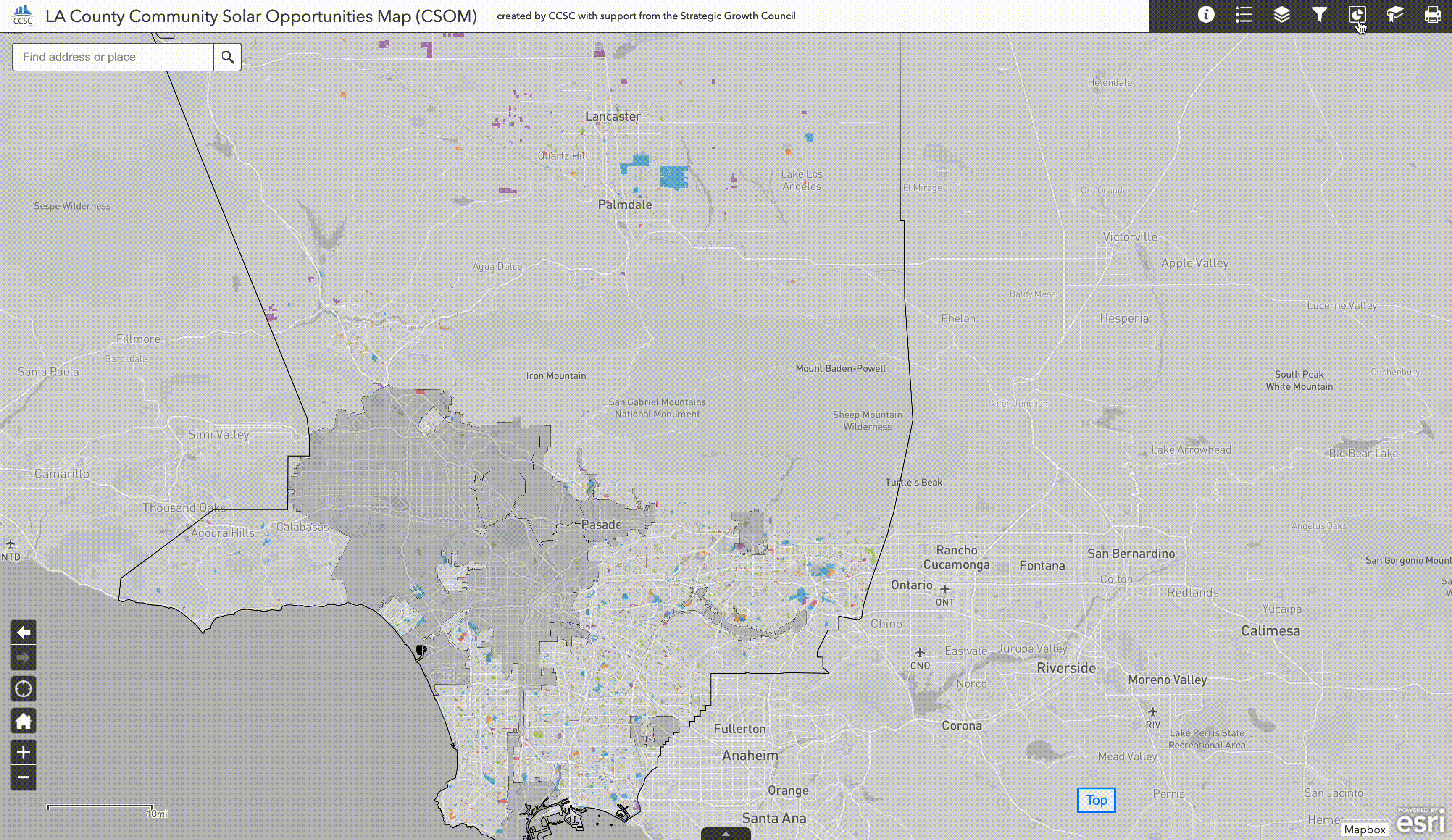
Zoom into the map using the + and - controls in the bottom left corner of the tool. Zooming in on the map changes the number of sites within view. However, this is different from creating a new selection of sites which can be accomplished through the sequential application of one or more different filters. When a new selection is created (i.e. sites are removed from view) this selection propagates to other features of the map such as the cumulative solar potential infographic which will later be introduced.
Troubleshooting
Returning Home
Occassionally, users may find that they have accidentally zoomed or panned very far away from the LA County region where the tool's data layers are available. If this happens, the quickest way to return to the default zoom extent is by clicking the home icon in the navigation button cluster in the lower left hand portion of the map.
No Sites Visible
It is possible during the compositional use of the filtering components that the user could provide a set of filtering constraints that restrict all sites from being part of a selection. This will cause no sites to be rendered within the map.
Clearing All Filters
Related to the previous issue, if the combination of filters have become too restrictive or you would like to quickly clear all of the filters to begin the site selection process anew, the easiest way to go about it is to simply refresh your browser page which will reload the map to its default settings and clear all filter settings in the process.
